 Heading northeast from Wisconsin to Michigan’s Upper Peninsula, we drove along the lovely shore of Lake Michigan before turning inland. At Munising, the town at Pictured Rocks National Lakeshore’s western gateway, Lake Superior came into view. We had hoped to arrive early enough at to snag a site at one of the first come-first served campgrounds there. What we hadn’t banked on was crossing into Eastern time, putting us an hour behind Michigan tourists vying for those prized camping spots. We came up empty at the national park campgrounds and so stopped in at Kingston Lake, a Michigan state park in the inland buffer zone sandwiched between the two ends of Pictured Rocks.
 Happily, we found a spacious location right on the lake with tall pines framing the view like a picture window. What’s more, a serviceberry bush next to the tent was fruiting, and blueberries were just starting to ripen in shrubs throughout camp. I gathered and ate as many as I could find, but Hector was afraid to sample them for fear they were poisonous lookalikes. Obviously, I’m writing this a few months later so the tasty berries were not poisonous.
 We inflated the kayaks and explored the lake, seeing many turtles, fish, a pair of loons in the water and a bald eagle soaring overhead. With just a slight breeze to cool us off, the water was calm and paddling conditions were perfect. In contrast, out on Lake Superior — the world’s largest freshwater lake — the water rarely tops 55 degrees and wind and waves can change dramatically in a very short time, so park staff discourage anyone from going out unless they don a wetsuit and have a sea kayak with a spray skirt. In addition, the 15-mile stretch of sandstone cliffs and caves at Pictured Rocks can imperil even experienced kayakers when the weather turns rough. And the stable flies that make life miserable for visitors to Lake Superior in July are much less of a nuisance inland.
 So it was just as well we camped and padded inland at Kingston Lake. We went out several times to explore Kingston’s small coves and channels through the reeds, finding the most adorable baby turtles near our launch site. The pair of loons always kept us at bay, diving down each time we got within 100 yard to reemerge at an even greater distance from us.
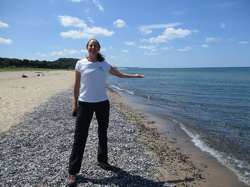 We spent another day checking out the eastern end of the national park, starting at Grand Marais. From this cute little town on a pretty bay, we explored the shore of Lake Superior. Similar to when we were at Indiana Dunes National Lakeshore on Lake Michigan, the blue water and sandy beaches here made us feel like we were at the ocean. However, soon the stable flies chased us back into the car.
 We proceeded to nearby Sable Falls for a hike through the forest to where Rhody Creek flows into Lake Superior. The Grand Sable Banks and Dunes begin here and stretch eastward for several miles nearly to Grand Marais. We sat on the beach at the mouth of the creek sorting through smooth granite and sandstone pebbles in every shape and color, once again until the stable flies bit through our clothing and drove us from the beach.
 We stopped next at the Log Slide Overlook. Loggers in the late 1800s created a cut in the dunes to send white pine, beech and maple logs careening down from the forest atop the cliffs and dunes to the water below, where waiting barges would ship them east to the port of Cleveland on Lake Erie. All told, more than 14 million board-feet of lumber came out of the forests here.
 We took the two-mile trail that followed the plateau’s now-reforested land over to the Au Sable Lighthouse. Built in 1874, the lighthouse still operates as a warning to mariners about the dangerous Au Sable Reef. As we neared the lighthouse, the trail descended steeply through the woods and then followed the shoreline. The stable flies appeared again, becoming increasingly numerous and vicious. They swarmed thickly, especially on our lower legs. It took only a few minutes of this torture — despite head nets and ample repellent — to send us fleeing into the woods for cover. We ran for a good 10 minutes without stopping. Back in the safety of the forest, we felt cheated of what could have been an excellent hike and exploration of the lighthouse. We returned to camp with dampened spirits but relief at being away from the flies.
 The next day we had booked a late afternoon boat trip on the lake even though we also wanted to hike a 10-mile loop from the Chapel Lake trailhead. Not wanting to give up either activity, we had to move quickly. The hike began with a gentle walk through the forest past Chapel Falls and out to the shoreline at Chapel Beach. There, above a delightful sandy beach at the mouth of the creek, a pine tree sits perched atop Chapel Rock. Formerly connected to the mainland via a sandstone archway that collapsed in the 1940s, the tree is now kept alive by its long root that stretches some 15 feet or more across the water below.
 From there we followed the North Country National Scenic Trail along the lakeshore, which connects numerous beaches and iconic rock formations in the park and in fact connects New York to North Dakota. The trail climbed to a plateau offering magnificent views of the lake, with occasional dramatic peeks at the cliff faces, caves and sheer drop-offs, some of which rise 200 feet above the water. These are the Pictured Rocks.
 We hurried past Mosquito Beach and the large rock shelf extending out into the lake that creates an inviting, shallow place to swim in relative safety. The trail veered back inland and undulated through the woods, eventually reaching Mosquito Falls and then circling back to the Chapel Lake trailhead. At least during our visit, we encountered no mosquitoes, and the trail was remarkably free of those biting flies that had plagued us the day before.
 We drove on to Munising, arriving just in time to board the large catamaran that toured Pictured Rocks from the water. The two-hour trip took us past many of the same points we had visited on foot above the cliffs, so we kept an eye out for hikers on the plateau. We had seen numerous boats earlier in the day from the trail, and now we enjoyed seeing the cliffs — with their bar-code drip stains in a variety of hues — from the water. The tour guide provided interesting commentary and stats on both Lake Superior and the rock formations, making this an excellent way to see the park’s famous highlights for those not able to kayak out along the Pictured Rocks. (Of course, once we saw some of the kayakers on the water and the relatively calm conditions, we realized we could have gone out in ours.)
 Back at camp at about 9:30 that evening, we heard country music and drunken cackling echoing across the lake. It was our camping neighbors — two boozy middle-aged couples — on their pontoon, and slowly the volume increased as they put-putted into camp. They docked long enough for the one guy to fall out of the boat, prompting even more mirth among the other three, and go for a chainsaw. They talked of cutting firewood from a downed tree in the water on the other side of the peninsula, and we thought they were joking. But the guy fired up the chainsaw and assured the others he’d cut plenty of wood in his time, although admittedly not drunk, from a boat, with precious little daylight left, and in swim trunks and flip-flops. Off they motored, and we could hear the buzzing chainsaw accompanied by hoots of laughter, which we were sure at any moment would turn into shouts of distress or at least a loud splash.
By 10 p.m. — supposedly quiet hours in camp — they had finished cutting their firewood and pulled up in front of their campsite. They stumbled to shore, cracked open a few more beers, lit their campfire and turned up the radio (which of course they then had to shout over). I was amused by having camping neighbors that were even more colorful than the Pictured Rocks, but Hector stewed until 3 a.m. when the radio batteries died and they all finally passed out. This camping trip ended on a less than superior note for him.
Glad to hear you finally survived the biting flies…great picture. I would also be very upset with the roundy camper neighbors…maybe some good earplugs would help. Stay safe!
Believe it or not, the noise cut right through the earplugs!
Bugs, bugs and more bugs. The water looked so green and others so blue. Pictured Rocks was quite a site. You are lookin’ good.
Onward!