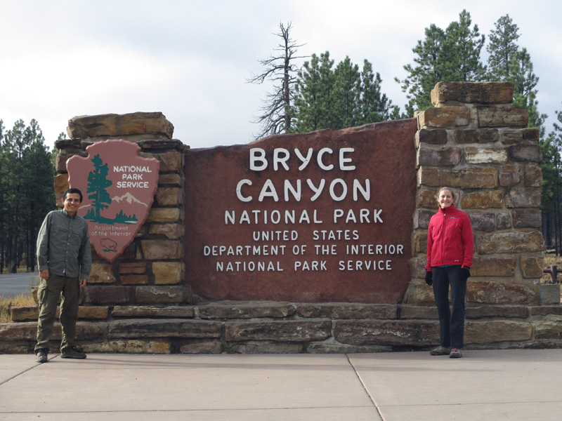
 Bryce Canyon National Park in Utah is nature’s sculpture garden, where hiking paths allow visitors easy access to fancifully shaped geologic wonders. Not a canyon in the usual sense of the word, it’s rather a plateau atop 14 amphitheaters of limestone that has eroded into an incredible array of rock formations resembling standing crowds of people, assorted body parts and a veritable menagerie of stone animals.
 After a brief introduction at the Visitor Center at the north end of the plateau, we headed south on the rim road through the park. During the high season, a free shuttle bus provides transportation to most of the viewpoints and trails in the park, but service had ceased a few days before our late-October visit so we were on our own. We decided to begin at Rainbow Point at the southern end of the road, then stop off at the viewpoints on our way back north.
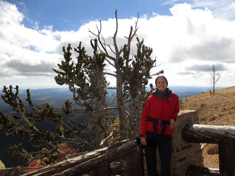 We did a few short hikes at Rainbow Point, including the Bristlecone Loop that led through spruce-fir forests to a collection of bristlecone pines, which had fascinated us in Great Basin National Park.
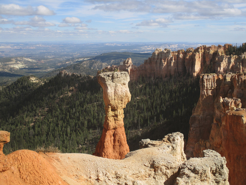
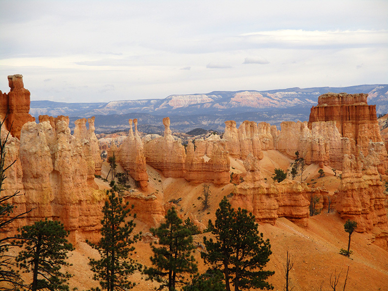
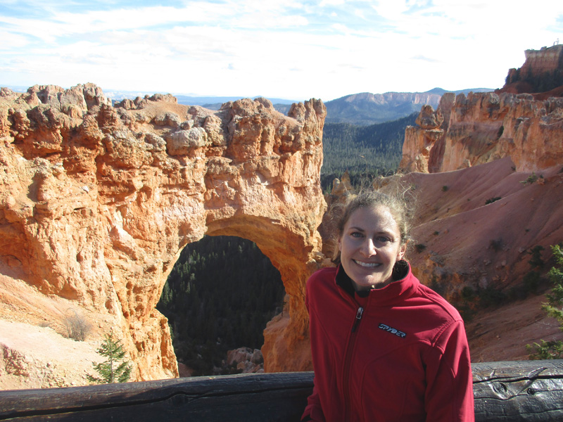 As we drove back north along the rim road, each viewpoint seemed more awe-inspiring than the previous one. Pink, yellow, orange and white limestone cliffs and rocks display an untold number of shapes: spires, pinnacles, windows, arches and the compellingly named hoodoos (odd-shaped pillars of rock).
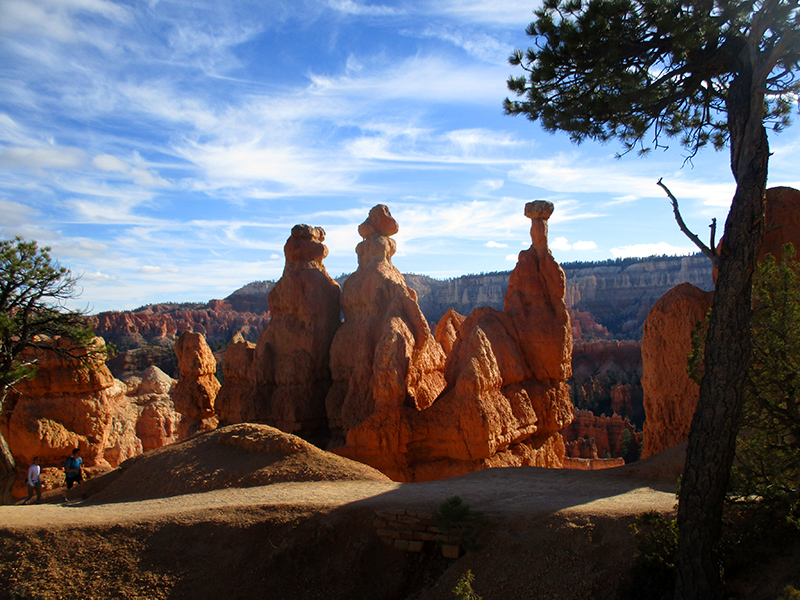 In fact, hoodoos are one reason this national park exists; the world’s largest collection of hoodoos occurs here. It first became a national monument in 1923, then a national park the following year, and in 1928 underwent a name change in honor of local settlers Ebenezer and Mary Bryce.
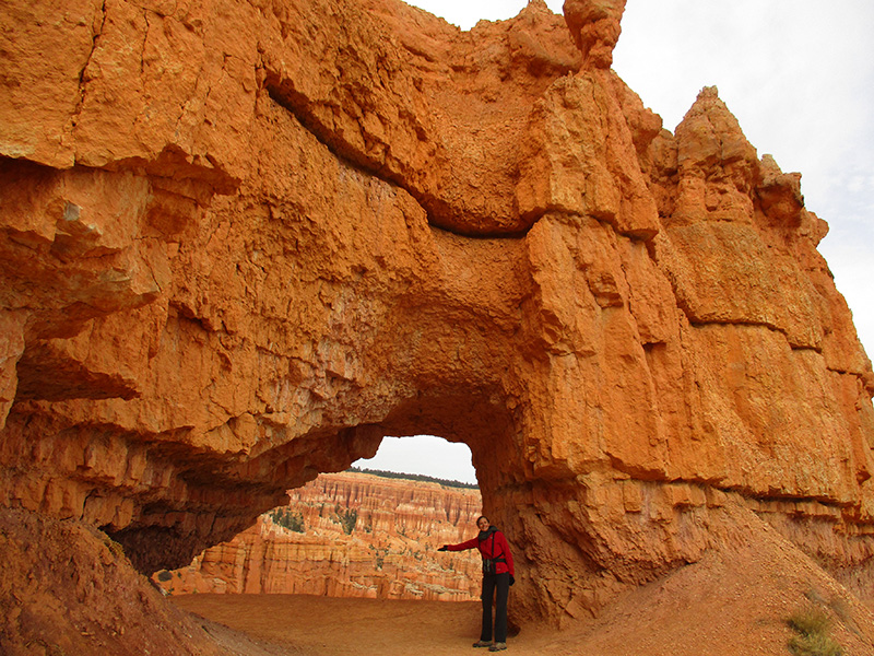
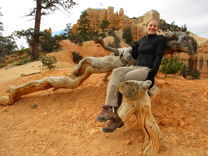
 At Sunset Point, we descended along the Queens Garden Trail into one of the amphitheaters, then looped back up along the steeper Navajo Trail that wound its way through “Wall Street” and switch-backed up to the plateau. Even mid-week and off-season the trail was rather crowded, especially with French tourists.
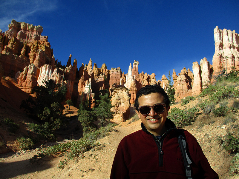
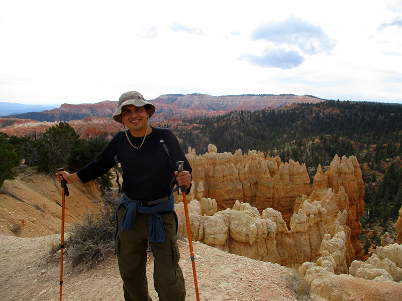
 Like many of those tourists, we participated in the “Hike the Hoodoos” challenge, a scavenger hunt of sorts to encourage visitors to exercise while in the park; those who can prove they’ve hiked at least three miles receive a “special prize.” I love a challenge, and Hector and I both love to hike, so over the course of several days we easily found a number of the “Hike the Hoodoos” survey markers while out on the trails. We took photos of ourselves next to the benchmarks and showed them to the ranger back at the Visitor Center for our prize. We expected something useful like a reusable water bottle, but the prize turned out to be merely a “I Hiked the Hoodoos” decal. Oh, well. The best reward is staying in shape.
 The following day we hiked a small portion of the 23-mile Under the Rim Trail from Bryce Point, switch-backing down to the Peekaboo Loop Trail. Winding through the heart of Bryce Amphitheater, the Peekaboo Loop reminded us a bit of the Grand Canyon’s South Kaibab Trail.
 It called to mind the Kaibab not only because of the fantastic canyon views and dust-coated rock of the path’s surface, but also because, with horses permitted on both trails, the air is perfumed with what the four-legged beasts leave behind. Huffing and puffing back uphill after the 1,571-foot drop into Bryce Amphitheater, the smell of horse manure was not something we wanted to inhale too deeply. But the trail provided a good workout, and pleasant views of rock formations near and far more than made up for the unpleasant olfactory accompaniment.
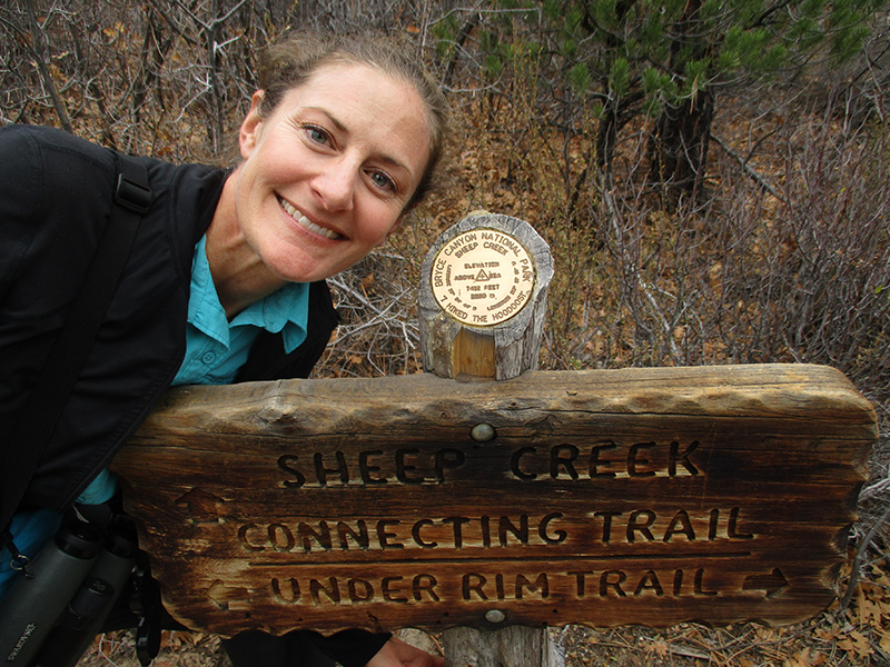
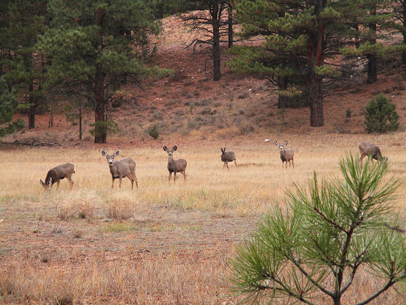 On another day we proceeded to the Swamp Canyon viewpoint to hike the four-mile looping trail that descended into a pinyon-juniper forest and returned along Sheep Creek. This is the trail to hike if you want to get off the beaten path, and park materials say that good route-finding skills are essential here. We had no problem following the cairns marking the way, but we saw no other hikers on the trail. In fact, the only other mammals we saw at all were some mule deer as we topped out at the large meadow on the plateau near the end of the hike. Once back in the car driving on the rim road, we did see a few prairie dogs, pronghorn and additional mule deer, but more people come to Bryce Canyon for the rock formations than for the wildlife.
 Our final hike was on another lightly used trail, the eight-mile Fairyland Loop Trail. The loop includes a section of the Rim Trail — which runs for 11 miles along the plateau — before dropping into the aptly named Fairyland Canyon. Thanks to a 1,716-foot elevation change, we had another great workout, and the path undulated repeatedly to make the loop less tiring than a simple down-and-up trek.
 Here in Fairyland Canyon, rock formations such as the Chinese Wall and Boat Mesa — along with hoodoos galore — rivaled those in nearby Bryce Amphitheater. The trail also provided distant views of the Tropic Valley outside the national park boundary. With such impressive views and so many incredible limestone sculptures on display, it was impossible not to be awed. Every step and every turn in the trail reminded us that Bryce Canyon rocks!
Well, I must say that you sure hiked a lot of miles to get awarded with only a “decal”. You took some great pictures of the amazing rock formations. Camping must have been decent, I didn’t read of anything otherwise, that’s good news.
Onward!
We opted not to camp in Bryce because the temperatures were so low during our visit, despite sunny weather. Staying in a hotel was the way to go here!
Some very nice pictures! Dannel and I visited there years ago and I remember the beautiful and pinkish rock formations. We didn’t do any hiking though…a beautiful park!
Luckily, Bryce is one of those parks where you can see so much without having to get out on the trail.
One small, but significant correction…..The Queens Garden Trail starts at SUNRISE POINT, not Sunset…..easy to confuse the two. Right now, 2019. the Navajo Loop is closed….it is popular combine the two hikes…..a favorite with many hikers….You can access the Queens Garden trail from Sunset…BUT…only if connecting trails are open….right now, they are not.