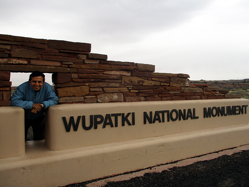
 The outskirts of Flagstaff in northern Arizona host two combined national park sites, Wupatki National Monument and Sunset Crater Volcano National Monument. Of the two, Wupatki is for more interesting, but with an early start it’s easy to fit both into a day’s exploration. We started at Sunset Crater at the south end of the Loop Road, which connects the two parks.
 The 1,000-foot-tall Sunset Crater volcano erupted sometime between 1040 and 1100, spewing ash for 800 square miles and two lava flows that left behind vast fields of rough, black rocks. This cinder cone is the newest mountain in the Flagstaff area’s San Francisco volcanic field.
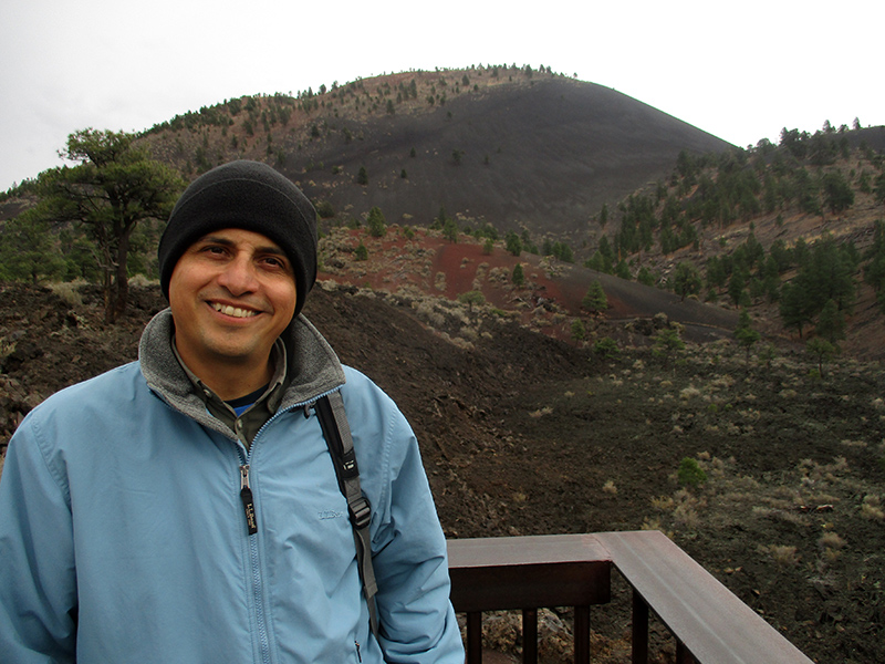 Although the crater itself can no longer be climbed because of its fragile cinder surface, we hiked the easy Lenox Crater, Lava Flow, Bonito Vista and A’a trails with views of Sunset Crater. The trails are short enough that even dawdlers wouldn’t need more than two or three hours to hike them all.
 Moving on to the more interesting part of the two-park complex, the ideal first stop is the Wupatki Visitor Center, whose top-notch interactive exhibits on the cultural history of the area provide a helpful overview of the people who eked a living out of this dry and inhospitable landscape.
 Roughly 800 years ago, the inhabitants — archaeologists refer to them as Sinagua, meaning “without water” — built structures out of sandstone and limestone bricks. Like the Ancestral Puebloans in Mesa Verde, they had meticulous masonry skills, and their constructions blended in perfectly with their surroundings.
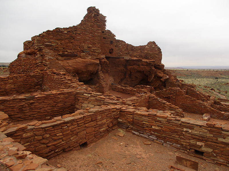
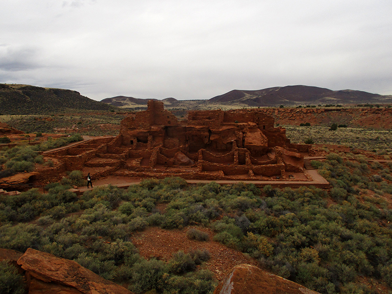 Exiting the rear of the Visitor Center, we took the short trail that led to the main Wupatki Pueblo ruins. This large, multi-level, 100-room village sits on a patch of open grassland. At the height of its occupation around the time Sunset Crater erupted, perhaps up to 100 people lived here. That doesn’t seem like many, but life was hard with marginal soil at best and little rainfall to water their crops of corn, beans and squash.
 Even more importantly, Wupatki served as a gathering place. It was a regional trading hub sitting at the crossroads of several trade routes for the Sinagua as well as Cohonina and Kayenta cultural traditions, with goods such as scarlet macaws brought from as far away as tropical Mexico some 2,000 miles to the south.
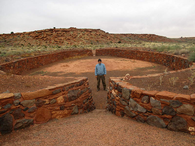
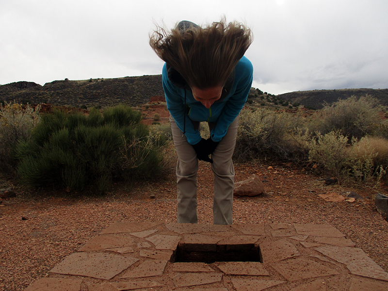 Other interesting features at Wupatki’s main pueblo site include a ballcourt, a circular-shaped community center and a blowhole out of which air shoots up from underground when the barometric pressure is higher below ground than above. The current was so strong it blew the curls out of my hair!
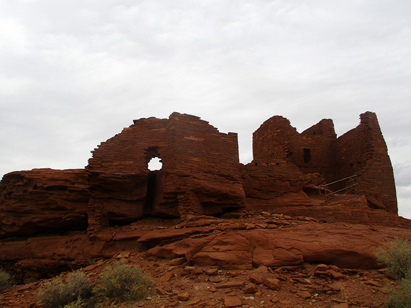
 Next we stopped at the Wukoki Pueblo site, where the remains of a three-story structure of sandstone and limestone bricks sit perched on a rocky hilltop. The ruins reminded us of Ireland’s Rock of Cashel and the remnants of a Cistercian monastery in the field below the hill. You can walk into the half-dozen rooms that archaeologists believe two or three families inhabited and try to imagine what life must have been like in these solidly built stone quarters.
 We ended the day touring the much smaller Box Canyon dwellings and Lomaki, Nalakihu and Citadel Pueblo sites. Here in these smaller sites, we had the place to ourselves. Perhaps it was the misty weather rolling in on a chilly mid-November afternoon. Perhaps visitors could sense a lonely abandonment, even more so than at the larger sites, and bypassed them.
 It’s easy to visit an abandoned place and wonder where the inhabitants “disappeared to.” Yet, like Mesa Verde, just because the buildings were left empty doesn’t mean the people disappeared. They might have moved away, but descendants of the Sinagua live on today as members of several Hopi clans as well as Zuni and other tribal groups in Arizona and New Mexico. Harsh as this landscape may be, this corner of Arizona has a magical pull on people that keeps them coming back to walk in the footsteps of those who went before.
A very desolate land, but it seems there were always some hardy souls willing to eke out a living in these places. I suppose there was a close-by water source or how else could they survive? Today, thank heaven for the Colorado River that supplies water to most of the Arizona residents. I got thirsty just looking at your pictures.
Onward!
They got by mostly on rainfall and water from a few small springs. The Little Colorado River — about seven miles away as the crow flies — would have had water seasonally, too. Tough way to make a go of it, that’s for sure.